Dokument

Dartmoor, Devon
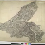
This drawing shows the estuary of the River Dart flowing into the English Channel. Numerous slate and limestone quarries surround the busy port at Dartmouth Harbour. Dartmouth Port also served the tin and copper mines on Dartmoor. Tan yards are marked at Totnes and Ashburton. Many cider orchards are noted. An Old Cross is drawn at Saint Petrocks (St Petrox) near the ruins of a castle across the estuary at Kiln Cove. Another castle appears at Totnes. The ancient earthworks at Woodbury Camp and many other early settlements are recorded in this area. While the authorship of this drawing is unknown, the elaborate hill shading and attention to communications routes conform to the military and cartographic standards employed by the West Country survey. The map is made up of three pieces. Its margins are trimmed and the drawing is in good condition.
The British Library1803

