Compara

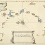
A New And Correct Map Of The Caribbean Islands From The Latest Observations
This map of the West Indies by Archebald Bontein was published in 1751. Bontein was the Chief Engineer in Jamaica and published a map of that island in 1763. A system of colour codes and letters, with the key in a panel at bottom centre, identifies the various European dominions in the region.
The British LibraryBontein, Archibald. Cartographer
1751

